Ladakh – Landscapes of the High Passes
Every traveller becomes a photographer-at-ease on his/her journeys through Ladakh. As a friend who recently returned from Ladakh remarked, every photograph looks like it is post-card worthy. Sometimes, this incredible landscape comes with its challenges. It becomes difficult to make images that are distinct from the millions of frames that flood the internet and to capture something that stands out from the rest. But an effort goes on, nonetheless.
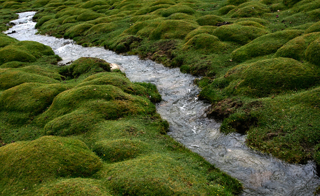
Ladakh is a high altitude desert with barren slopes, stark landscapes and treeless terrains. Yet, it has no shortage of water which flows abundantly from snow melting through the summer months and feeding its streams and rivers. In the rare occasions where you see some table lands fed by such streams, you also see an eruption of greenery that is a contrast from the brown landscapes surrounding it. Here is one such place near Tso Moriri Lake.
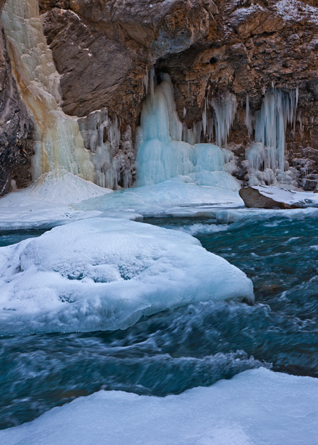
While Ladakh is easily accessible in the summers and rewards the visitors with its beautiful landscapes, jaw-dropping spectacles unfold in the winter months. Temperatures dipping twenty below zero changes the way the world appears, like in the case of this waterfall that stays frozen during the winter months next to a blue Zanskar River.
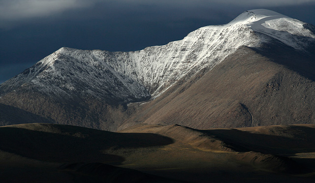
Snowfall is rare in the summer months. But when it happens, a day of snowy surprise can bring in magical changes in the landscapes. This mountain, near Tso Moriri Lake, was largely brown on the day I arrived here. It snowed one night and remained cloudy for the large part of next day. The slopes were transformed by the fresh, powdery snow.
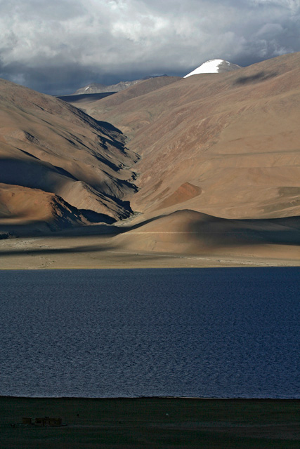
One of the prized possessions of Ladakh are its vast, blue lakes that are trapped in the depressions of changthang plateau. Tso Moriri is one such lake whose blue colours stand out against the chocolate-brown slopes surrounding it. Next to the lake is a small pasture that feeds the animals. and fields that feed the people of Korzok Village overlooking the lake.
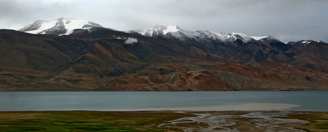
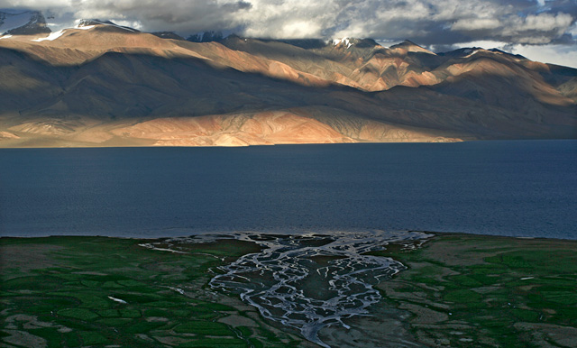
Tso Moriri takes different hues in different weathers, varying from deep blue on a sunny day to a dull grey when it is cloudy. Perhaps it simply reflects the colour of the sky, calling nothing its own. The lake is fed by streams like the one in the picture above. The lake’s waters have no outlet, because of which it is turning salty over ages. The waters of this brackish lake tastes mildly salty, if at all, and has only a fraction of saltiness that the seawater possesses.
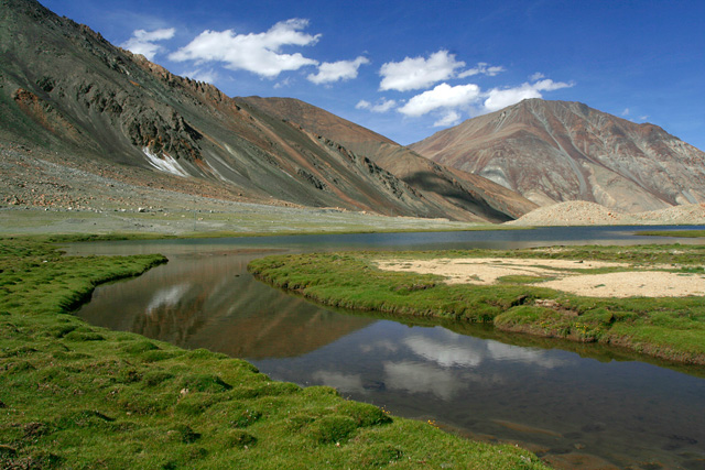
Pangong Lake is another brackish water lake in Changthang Plateau. But one doesn’t have to take Ladakh destination by destination. Stop anywhere for a break and you will find something beautiful, like this unnamed lake on the way to Pangong Tso.
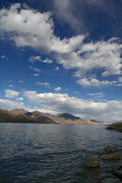
Pangong Lake itself, is the grandest of all water bodies in Ladakh, perhaps in the whole country. It stretches for more than a hundred kilometers across two countries. A man from Indian Army who helped me park my bike here said, ‘do you see the mountains far away? They are in China’.
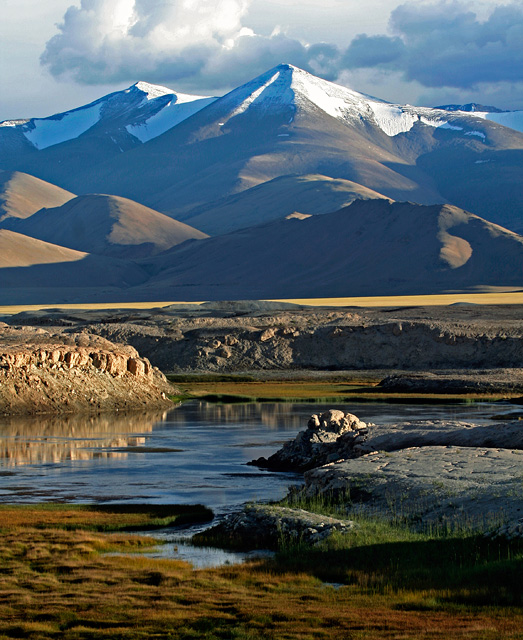
Another large lake in Ladakh is Tso Kar, which is more of a marshland than lake. The huge plain of Tso Kar allows plenty of grass to grow in the plateau and in turn supports a variety of wildlife that feed on this grass.
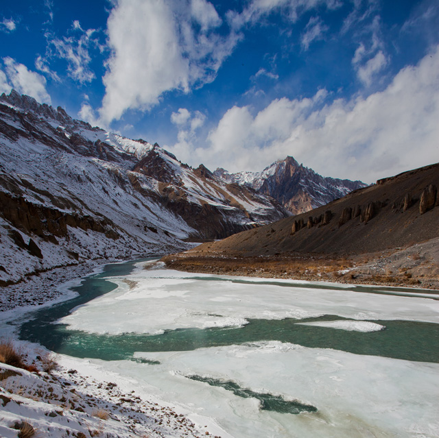
Tso Kar Lake and rest of Changthang Plateua lie on one side of Manali-Leh highway, while on the other side is the still-remote and inaccessible Zanskar Valley. The lone road to Zanskar remains closed for nine months a year, buried in snow. In the winter months, the frozen Zanskar river then becomes the highway for people of Zanskar.
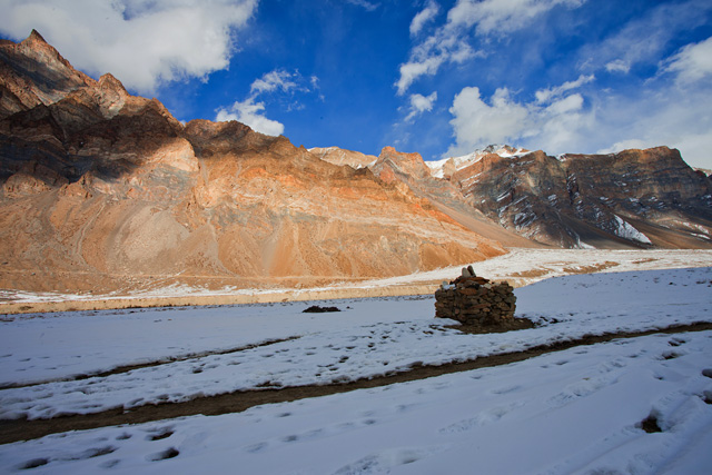
Snow filled Zanskar Valley in the winter months.
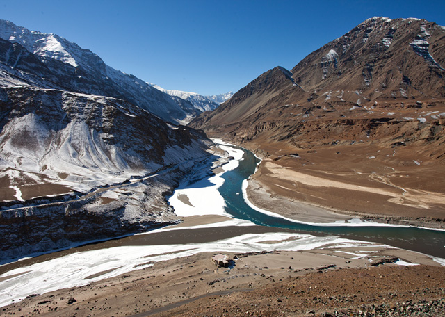
Zanskar River enters Indus Valley and merges with River Indus near a village called Nimmu. In the above photograph is the confluence, seen from the slopes nearby. The deep blue river emerging from the mountains is Zanskar, while the muddy flow from the left is Indus River.
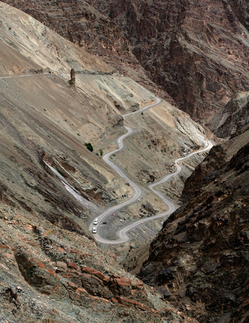
Further, downstream Indus is the village of Lamayuru, which is approached by switch back roads climbing swiftly along the steep slopes. Some turns along the way are so tight that buses have to go back and forth to get past a curve. This road is part of the Srinagar-Leh highway.
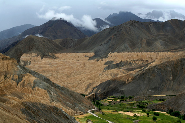
Lamayuru Village is located in a place that was once inundated with waters of a high-altitude lake. The presence of the lake is apparent even today, thanks to curious formations left behind from the drained lake. The yellow slopes, often called moon-land-view, clearly indicate the level of the lake’s water.
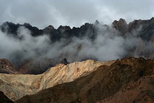
Play of sun and clouds on the mountains of Lamayuru.
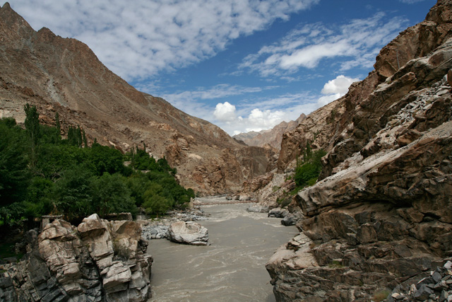
Further downstream, at the edge of Ladakh before Indus flows out of territory accessible from India, the river flows swiftly through a very narrow gorge near the village of Dha. In here, the river descends below ten thousand feet after flowing for a long distance in the highlands of Tibet and Ladakh. The mountains here are steep and the valleys are narrow, but the weather is more hospitable and permits growing a variety of fruits and vegetables. This is perhaps the only place in Ladakh where it is possible to grow wheat.
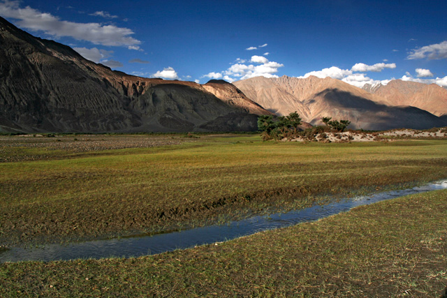
In another corner of Ladakh, towards north, is Nubra Valley, another green oasis in the barren lands of Ladakh. In the wide valley of Shayok River, tiny grass and seabuckthorn shrubs grow in plenty, supporting a small herd of wild bactrian camel. The lush valley with plenty of water from the river allows the people of Nubra Valley to grow many cereals and vegetables, besides juicy apricots.
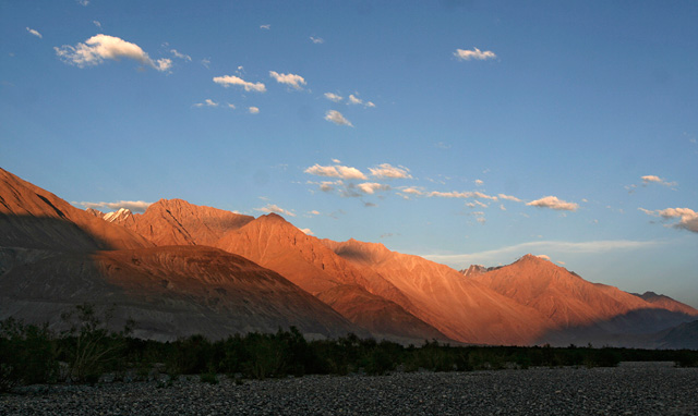
Sun setting over the mountains of Nubra.
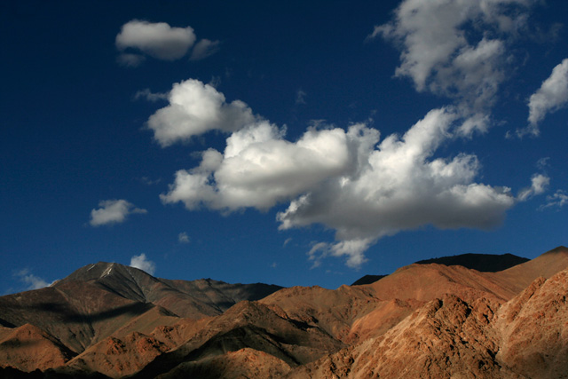
But one doesn’t necessarily have to travel far and wide to every corner of Ladakh to see its amazing landscapes. As soon as you arrive in Leh, you will see tall mountains, puffy white clouds and blue skies welcoming you to Ladakh. A small walk outside Leh is perhaps sufficient to get the glimpses of Ladakh’s landscapes. The explorer, however, has no limits to to what he can see in Ladakh.