This article appeared in Spectrum, Deccan Herald’s Tuesday Supplement on January 18, 2011.
In the seemingly arid landscape along the National Highway 4 between Bangalore and Tumkur, there lies a stretch of thick forest and a series of hills that sometimes reminds one of the rich greenery and the slopes of Sahyadris. Moving off the highway near Tumkur towards the temple atop the hill at Devarayanadurga, I was surprised to see the boring and wide open highway make way to a leafy stretch of road with dense pack of trees on both sides. The winding road took me to a small perennial spring—Namada Chilime—in the heart of the forest.
The spring water trickles from a depression on a big rock and flows down to fill a pond just below. Legends attribute the spring’s origin to Lord Rama. Rama needed drops of water to smear ‘nama’ on his forehead and decided to extract it by shooting an arrow into the rock. A spring emerged from the rock and was called Namada Chilume.
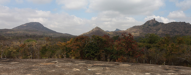
The hills surrounding Namada Chilume
The area around Namada Chilume is a leafy stretch with an enclosure that serves as a deer park. Across the park is a small rocky hillock with a mantapa, which offers views of the forest and the hills around the spring. In the view from mantapa are hills covered with shrub vegetation at their base and tall boulders higher up. In the early days of January when the trees are ready to shed leaves, the landscape occasionally sees a dazzle of yellow and red – as good that the fall colours can get in the tropics. To the east is Devarayanadurga, the tallest hill in the view with a 150-years old temple at the top.
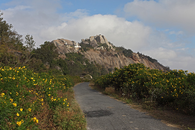
Lakshmi Narasimha Swamy Temple at Devarayanadurga
The foundation of Lakshmi Narasimha Swamy Temple at Devarayanadurga is credited to Hoysala Kings. Its current structure is attributed to the Wodeyar Kings of Mysore. Our road from Namada Chilume to Devarayanadurga meandered through a thick shrub forest as we drove through some steep climbs and switch backs before arriving at Durgadahalli Village just below the temple.
Climbing further to the peak and standing atop Devarayanadurga, nothing blocked my views all the way to the horizon as I looked at the villages on the plains to the east. The northern side of my view had a range of hills that tapered away gently into the plains. Lakes of various sizes glittered in the early morning sun all along the plains, standing out amidst the thin winter fog that hid the details of the landscapes. To the south, a sharp rocky ledge jutted out in the hazy weather as the sun rays filtered through the fog and selectively brightened its half-dome-like peak an an unusually sharp summit pointing towards the sky.
A series of hills decorate the landscape around Devarayanadurga. A thirty-minute drive further north took me to Madhugiri town dominated by a tall rocky hill, whose slopes are criss-crossed by several layers of fort walls.
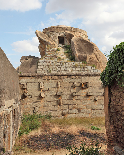
A section of Madhugiri Fort
Madhugiri hill is at an elevation of 3930 feet and is the second largest monolith in Asia. The first work on Madhugiri Fort dates back to Ganga Kings, while the walls remaining today are credited to a local chieftain named Heere Gowda, a feudal of the Vijayanagar Empire. Since the collapse of the empire, the fort was administered by Hyder Ali, Tipu Sultan and later by the Mysore Wodeyars. It is currently managed by Archaeological Survey of India.
Having made an impulsive decision to go up the hill, I climbed slow and easy. I pausing to look at a bastion that offered vista of the town, observed a waterway that filled up a tank in the fort, and stopped to take a good look at the fort walls and store-houses built along the way.
The initial climb is through grassy slopes that soon changes into steep rocky surface with nothing more than small etchings on the rock that served as supporting footsteps. Although the climb can not be called an activity that needed climbing skills, it was steep enough that I was occasionally forced to crawl up through slippery sections.
Standing at the bottom earlier, the climb to the peak appeared like an easy affair that may take no more than thirty minutes at most. But the deceptive fort walls built along the slopes hide the actual peak from the view, making it look like an easy climb. Several times I expected the peak to appear just across the next layer of fort wall, only to realize when I reached there, that it is a long way further.
As I was climbing up the slope, I was also becoming aware of the landscape around the fort, with hills dotting the surroundings and wide sprawl of lakes between them. Assisted by patches of clouds that blocked the sun, light and shadow alternated on the peaks, selectively highlighting some and subduing their neighbours.
It must have taken me more than 2 hours to reach the top and go through last of the fort wall. Located on the top are shelter built of stone that could house a few hundred people, perhaps meant to house the soldiers who guarded the fort. Standing on the top of one of those shelters, I was blessed with the views that made up for the effort of the climb. A series of hills marked the western landscape, dominated by a narrow and rocky peak projecting nearly as high as my platform. A thin road bisected through the hills leading somewhere into their heart and beyond.
The afternoon haze limited my views but the contour of the distant hills looked beautiful enough that I made a note to come back here again for an early morning visit. These hills along the Bangalore-Tumkur highway have many surprises, a lot of greenery and a rich history waiting to be explored.
Information
To reach Devarayanadurga, take NH4 out of Bangalore and drive till you exit through the toll gate near Tumkur. Turn right a little ahead of the toll gate the drive for another 20km to get to Devarayanadurga. This road takes you through Namada Chilume. Madhugiri Fort is another 30-minute drive from Devarayanadurga.
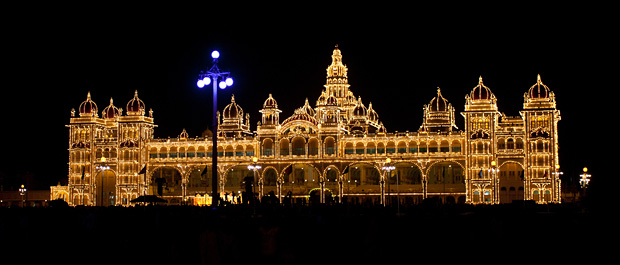
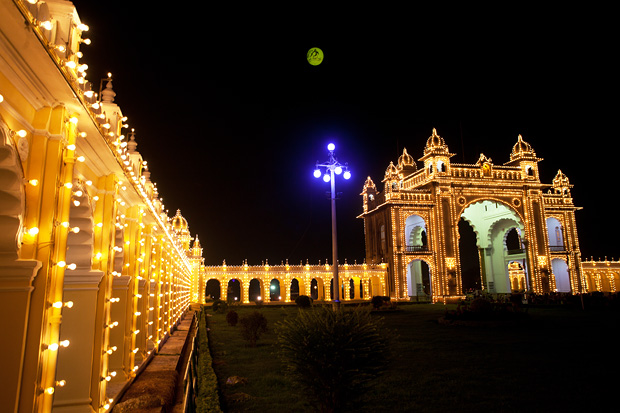
When the much publicized lighting come on at 7pm, the grandeur of Mysore Palace makes the most jaded traveler gasp for a moment and transports him into a fantasy land.
I had seen the palace lights a million times over in pictures and had set an expectation for the evening. I did look forward to seeing an elegant structure, tastefully illuminated. But in that moment when every other light in the vicinity was turned off and the decor lighting came on to built a palace outline formed just from tiny dots of light, I realized what is the feeling of being blown off from my feet like. It was like being in a fairy tale world and seeing something that only the best of the story tellers can imagine and narrate.
I made a short day-trip to Mysore to witness the Dasara celebrations. But at a time when the government was grappling with the problems of survival and had other imperative things to look after, the festival had become a low-key activity. There were information kisoks where people disseminated old tourist brochures but did not know the festival schedules. The famed mud-wrestling had now moved on with times and had shifted to a synthetic turf. The exhibition was not yet open and the cultural activities were limited to the evening hours. Our day at Mysore was limited to exploring the palace, and I am glad it turned out so.
Most of my visits to Mysore in the past were on transit. I admired the quiet, wide lanes of the town as opposed to Bangalore’s congestion. I was jealous of its open spaces and the lakes teeming with birds. But it was just once that I stopped to see the sights, and even then, did not visit the palace. I made up for the loss on that day of Dasara. When the festival did not offer the expected excitement, it became a day dedicated to exploring the palace.
Even when it became obvious from outside that it is a grand edifice perhaps filled with luxury, the insides continued to impress me at every corner. The tall pillars painted in turquoise, the grand wedding hall three-stories high, the dolls of marble and wood on display, the golden throne, chairs of crystal and silver, an unbelievable work of tusks inlaid into wooden doors, gilded decorations in the private darbar hall, the grand pillars and marble floors of the public darbar, an array of canons in the courtyard, exquisite paintings of dasara procession make up only a small part of the impressive palace. The architects of the palace have not stopped until every corner of the palace is perfected and every room is decorated in the best possible way.
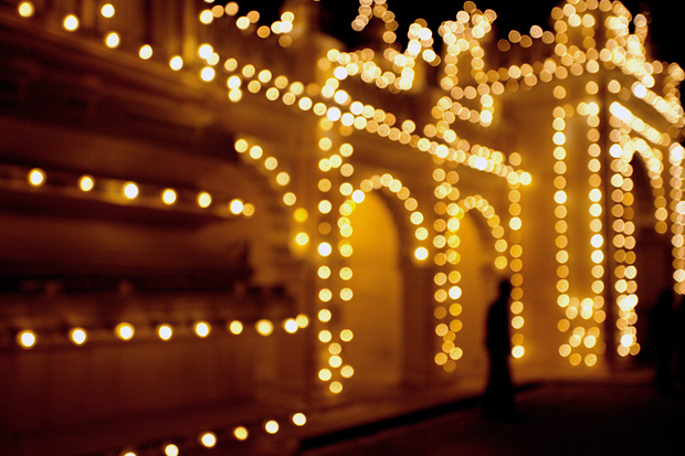
That evening when a cultural event was in progress in the palace premises, our eyes were focused on the edifice and its lighting. It looked like yet another beautiful structure in the evening hour as the floodlights focused on the walls. But the moment the decorative lights hugging every corner of the palace came alive, it was like a revelation of the maximum stretch of beauty. I admit, I haven’t seen anything else as grand and as beautiful yet.
Some images can be seen at a bigger size on paintedstork facebook page
As monsoon clouds move into the western ghats in the early days of June, the hills of Chikmagalur see a remarkable transformation. The vistas of grassy slopes and the dense forests of Bhadra Wilderness disapper under a blanket of thick fog. The fog never recedes for the next three months and it looks as if the skies have disappeared, never to come back again. But come September, it goes away as magically as it had arrived to reveal the beautiful blue skies and to welcome the warmth of the sun.
Chandradrona Parvata, commonly known as the hills of Bababudangiri Hills, host the highest peaks in Karnataka and is home to some of the densest rainforests in the region. I made a dashing visit to the hills this monsoon season and made an attempt to capture the foggy hillscapes. Here is a collection of images of Chandradrona’s Fog.
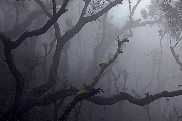
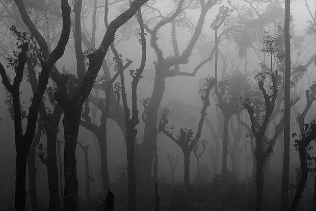
Coffee estates dominate the slopes of Bababudangiri. The district of Chikmagalur, along with neighbouring Coorg, grows bulk of the coffee produced in India. The need for a balance of sun and shade in coffee estates allows coffee growers to retain some of the trees that naturally grow in the region, but they constantly chop the branches and leaves to allow some sunshine to seep in. This creates a weird landscapes full of tall trees standing bare, often with only tender leaves sprouting from their hacked branches. Add a foggy monsoons that hides the details in the landscape and you get an eerie atmosphere in the hills.
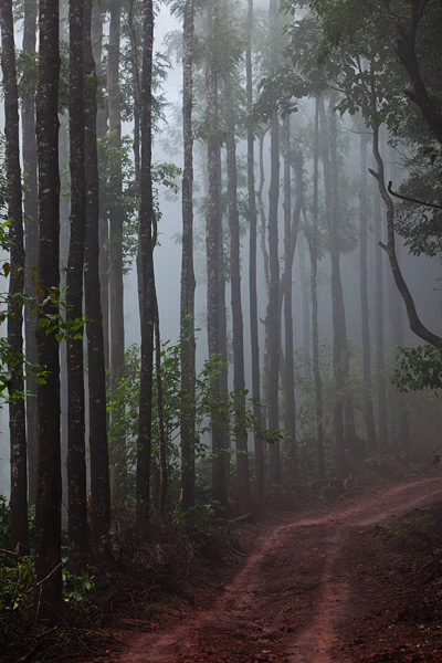
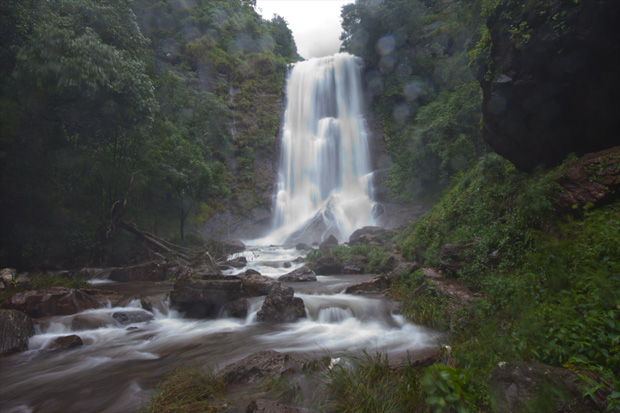
Many roads in the hills are without tarmac and sometimes you can barely call them roads. Many roads are also privately owned by the coffee estates that are spread over thousands of acres. We drove through one such road on an ancient Mahindra that lacked the luxuries of shock absorption. Sometimes we treaded over rocks when the road disappeared in stretches, each time double checking to ensure that our backs have stayed unbroken. The road lead to the roaring Hebbe Falls that was falling with full force in the peak monsoon season. I stood in the narrow valley of the stream and felt the wrath of the waterfall whose sprinkles made me completely wet in a matter of seconds. I went there determined to take a picture and decided not to step back despite being faced by a jet of droplets hurled away from the waterfall into me. Keeping the camera covered most of the time, I set it up on a tripod, composed blindly and hurriedly took a picture, exposing the camera in the open just for a few seconds. The lens surface became completely wet in those few seconds and you can see the droplets in the picture. I knew this was a task meant to fail, but I had no heart to come back without trying.
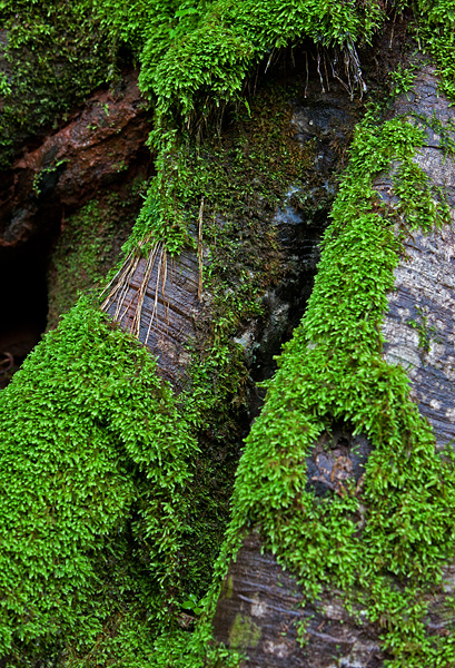
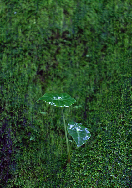
Monsoon is the season of fertility in the highlands of Chandradrona. Every exposed surface remains wet all through the three months of rain. Life in different shape, form and size grows effortlessly at the slightest opportunity; even tree trunks are never spared.
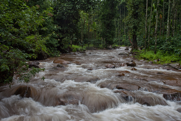
Innumerable streams crisscross the forests in these mountain, sometimes rushing down the hills in a great hurry and sometimes meandering gently through the forests. They come together in River Bhadra and feed the plains of the Indian peninsula. These streams come alive during the monsoons, charged by the continuous rains that keeps pouring throughout these three months.
Prints of all the images available. Request for prints.


