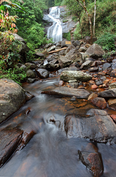
Here is another addition to the long list of weekend getaways from Bangalore.
We drove through some of the finest roads in the neighbourhood as the darkness made way for the first light of the dawn, on a not-so-chill winter morning last week. The obstacle-free NICE road and the toll highway to Tumkur let us clock the miles quickly and approach our destination earlier than expected.
The sun came out in his orange winter glow a little later than 6.30, when the air was still not warm and the body was still sleepy. I took shelter in the warmth of the car cabin and refused to join my fellow travellers—Srinidhi, Ravi and Santosh—in the rush to photographing the sun before his hues disappeared.
Further ahead, in Uradigere village just before the turn to our destination Devarayanadurga, a restaurateur had just started work on his grinding machine and could offer us nothing more than a cup of coffee. The road climbed up soon after, taking us through a forest surprisingly thick and beautiful for this terrain. The road meandered past a large rocky slope and a lake with its calm surface before arriving at Durgadahalli Village, above which was our destination.
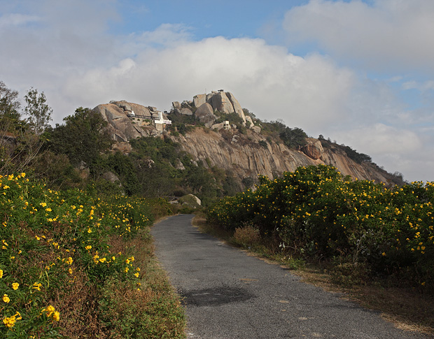
The approach to Devarayanadurga
Standing on the top of Devarayanadurga, nothing blocked my views all the way to the horizon as I looked at the villages on the plains to the east. The northern side of my view had a range of hills that tapered away gently into the plains. Lakes of various sizes glittered in the early morning sun all along the plains, standing out amidst the thin winter fog that hid the details of the landscapes. To the south, a sharp rocky peak jutted out in the hazy weather as the sun rays filtered through the fog and selectively brightened its half-dome-like peak, which attracted my eye with its unusually sharp summit pointing towards the sky.
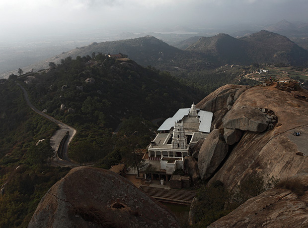
Lakshmi Narasimha Swamy Temple at Devarayanadurga
As one would expect to see anywhere on a high post all along the religious India, a temple stood below the peak of Devarayanadurga too, built on a narrow space just wide enough to accommodate its building. Wikipedia mentions of a history to the region that dates back to the Hoysala Kings and later to Vijayanagar empire, though the temple in its current form is attributed to the Wodeyars of Mysore. The sign at the temple indicated that the they open at 10am, but in the month preceding Sankranti, activity begins as early as 6am.
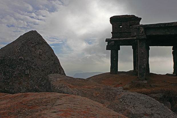
I sat on the rocky peak and let the strong breeze flow into me as I watched the world below appearing and disappearing with the drifting fog. As the day progressed and the sun gained strength, our stomach grumbled and complained of the missed breakfast, prompting us to head back to Uradigere.
Refulling with Thatte Idli served with a spicy chutney, we moved further to Namada Chilume, a sanctuary for deer in a vegetation surprisingly rich in this otherwise open terrain. Namada Chilume gets its name from a small perennial spring that trickles from a rock. The story goes that the spring was formed when Lord Rama in need of water shot an arrow into the rock. He needed drops of water to smear a nāma on his forehead, and hence the name Namada Chilume. In the adjacent sanctuary is a small fenced area that houses a group of spotted deer. A rocky aberration nearby hosts an ancient looking mantapa on a series of pillars, surrounded by thick vegetation that has begun shedding leaves for the winter. The surrounding hills and the nearby trees have a range of colours varying from green to yellow to a dark red, making up the best display of fall colours that you can see in the tropics.
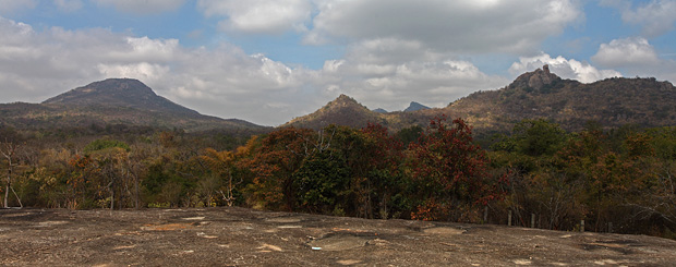
The vista from a rock near Namada Chilume
We proceeded further from Namada Chilume, circumventing Devarayanadurga whose tall peak stayed in our vision for most of our way. We had impulsively decided on our next destination as Madhugiri Fort, which had some surprises to offer us. More about Madhugiri Fort in another post.
Information
Devarayanadurga is a hill located approximately 90km from Bangalore. It can be easily done as a day-trip combined with a some of the other places nearby like Namada Chilume and Madhugiri Fort. The Lakshmi Narasimha Temple on the hill seems to be a popular place.
There are no restaurants at Devarayanadurga. If you are likely to be there at lunch time or planning to spend a lot of time, it is best to carry some food. A shop near the temple sells tender coconut, water bottles and some packaged foods like biscuits. About 15-minutes drive from Devarayanadurga is Uradigere village where you can get some basic food in small restaurants. There is no accommodation at the hill except for a forest department rest house. They might rent out the rooms, but it is recommended to check before you go.
There are two ways to get to Devarayanadurga. Head out on NH4 (Tumkur Road) from the city. After you drive for approximately 20km from the toll gate at Nelamangala, you will see a flyover at a place called Dobbspet. Go under the flyover and turn right and take the road leading to Devarayanadurga. There are no obvious signs indicating the arrival of Dobbspet or to provide directions to Devarayanadurga, so your best bet is to lookout for the flyover. After about 15km of driving, you will come to a junction in a village called Uradigere. Continue past Uradigere for about 250m where you see a left turn. Turn here and drive for another 15 minutes to reach Devarayanadurga.
Alternately, continue on NH4 till you exit through the toll gate near Tumkur. You need to turn right a little ahead (see map) and drive for another 20 minutes to reach Devarayanadurga. This road takes you through Namada Chilume.
Namada Chilume is a 10-minute drive from Devarayanadurga.
Below is the map and driving direction from Bangalore to Devarayanadurga
View Bangalore to Devarayanadurga in a larger map
View Bangalore to Devarayanadurga in a larger map
This post has travel information on Badami. See earlier posts in the series for travelogue on Badami
Badami is a small town in North Karnataka, about 500km from Bangalore. It is known for the remains of Chalukya dynasty, whose kings ruled a large part of Indian peninsula between Narmada and Kaveri between 6th and 8th century. Particularly well known are the cave temples – four temples that are cut from sandstone rocks. But there is much more to Badami.
Also well known is the group of temples in nearby Pattadakal, a UNESCO world heritage site. Aihole, another site of ancient temples and once a capital of Chalukyas is about 45km from Badami.
History and Legend
The Chalukya kings chose Badami as their capital in 6th century AD. Most of the ancient structures seen in Badami today are attributed to Chalukyas. The fort walls on the cliff above the caves temples is attributed to Tipu Sultan. Pallava King Narasimhavarman I conquered Badami for a brief period, but it was recaptured by the Chalukyas. Rashtrakutas ruled Badami from 8th century. The later Chalukyas, also called Kalyani Chalukyas or Western Chalukyas conquered Badami from Rashtrakutas in 11th centurey AD. In later years, Badami was ruled by Vijayanagar Kings, Adil Shahis of Bijapur, Marathas, Tipu Sultan and the British.
According to legends, Sage Agastya was invited by demon Ilvala for a meal during his journey south of Vindhyas. Ilvala and his brother Vatapi called guests home and killed them in the most innovative possible way. Vatapi would turn into a ram while Ilvala would cook the ram’s meat and offer it to the guests. Once eaten, Vatapi would come out splitting the stomach of the guest, thus killing him. Badami is said to be the place where the event occurred. Two rock faces around Agastya Lake are said to be the bodies of slain demons.
Places to Visit
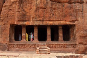
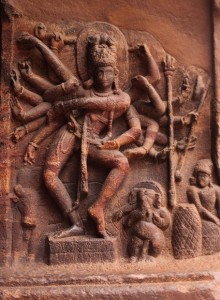
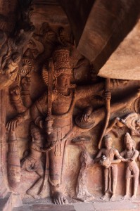
Cave Temples. Cave Temples are the most popular structures in Badami. A bulk of tourists who arrive in town simply visit these temples and go back. There are four such temples – three of them dedicated to Vedic Gods and the fourth one being Jain. Cave III is the largest and most elaborate of all these temple. All the caves have an array of square pillars and a simple sanctum inside, without a provision for circumambulation. The most elaborate of the statues in each cave are located at the walls on either side immediately after entering. Some of the attractive carvings include the statue of Nataraja in Cave I, Varaha and Vamana in Cave II and Vishnu in the third. The fourth temple has a series of carvings of the Jain Tirthankaras.
Beware of unruly monkeys while you are at the caves. They often snatch handbags and other things from tourists, even cameras.
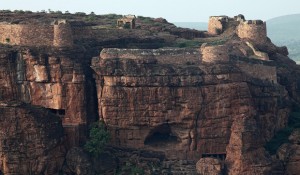
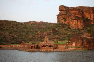
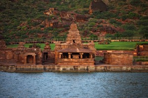
Agastya Lake, Bhoothanatha Temple and ASI Museum. The large tank facing the caves of Badami is called Agastya Lake. The lake once had boating facilities, but it has been stopped in recent past. Bhoothanatha Temple is a vesara style temple located at the edge of the lake on the northern side. The temple is in a dramatic setting with tall sandstone hills surrounding it in 3 sides and the lake on the fourth. East of Bhoothanatha Temple is a small cave, inside which you can see a statue of Buddha, now broken.
An ASI museum is located at the northern side of the lake. The museum has a collection of statues and a small model of Sidlaphadi, a rock bridge located at about 4km from Badami.
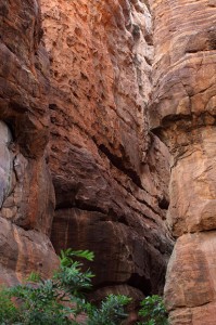
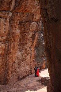
Sandstone Rocks and fissures. Agastya Lake is surrounded by hills made of sandstone rocks. Parts of these rocks have interesting gaps that serve as pathways to go up the hill. It is an interesting experience walking through these narrow gaps amidst tall, reddish sandstone rocks. Take the steps leading up from the ASI museum.
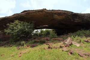
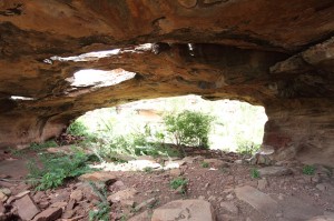
Sidlaphadi. Sidlaphadi is a rock bridge of sorts – a horizontal stretch of rock supported on both sides with a wide gap in the middle. ASI has found evidences of this place being a shelter to prehistoric man. Sidlaphadi is about an hour’s walk from the cave temples. Since there is no clear path, it is necessary to hire a guide to get there.
Nearby Places
Aihole. The village of Aihole is often called ‘The Cradle of Indian Architecture’ since it once hosted an architectural school. All around Aihole, you can see Vedic, Buddhist and Jain temples in various shapes and sizes dating to as far back as 6th century. Aihole is about 45km from Badami. Read more about Aihole.
Pattadakal. The group of temples in Pattadakal on the bank of Malaprabha River are declared as a UNESCO World Heritage Site. Pattadakal is about 20km from Badami. Read more about Pattadakal.
Mahakoota. A large temple in the quiet village of Mahakoota dates back to the time of Chalukya Kings. It has a distinct structure that isolates itself in size and architecture from other Chalukyan temples. The temple is characterized by large ficus trees surrounding it. A perennial spring feeds a tank in the temple premises. Visitors are free to take a dip and bathe in the tank. Mahakoota is about 15km from Badami. Read more about Mahakoota.
Banashankari. The ancient temple is Banashankari, 5km from Badami, is now a popular pilgrim center. It is more known for its annual fair which attracts large crowds. Read more about Banashankari.
Other places and things to do
Although Mahakoota is accessible by road, you can walk from Badami through the table land formed by the sandstone hills. The walk takes you through some interesting sandstone structures, shrub jungles and fields. There is no clearly demarcated path, so hiring a guide is advisable. It should take anywhere between one to two hours to get to Mahakoota. Start early in the day to avoid the blazing afternoon sun. Carry plenty of water. At the end of the walk, jump into the tank in Mahakoota Temple and rejoice in the clean spring water for as long as you like.
Naganathakolla is a village with a small temple from Chalukyan times. It is in a forested area and is usually void of people. It is located on the road from Banashankari to Mahakoota. If you come here by public transport, you may have to walk into the forest for about a kilometer.
Local transport
The monuments of Badami are within walking distance and about a kilometer away from the bus stand. You can hire a tonga or auto-rickshaw if you wish, but it should be easy to walk from bus stand. Banashankari is well connected by buses. Buses to Pattadakal and Aihole are not very frequent, so get the bus schedule and plan it properly if you intend to use public transport. Smaller private vehicles(Mahindra Matador) also ply to Pattadakal from Badami. Shared autos and infrequent buses are available to go to Mahakoota.
If you would like to be on your own, you can hire an auto-rickshaw or a cab at Badami.
How to reach.
Badami is about 500km from Bangalore, it is an overnight journey in a KSRTC bus. It is a long distance if you intend to drive, so reserve more than a weekend for a driving trip. Badami has a train station, but just has a few local trains arriving here. The nearest well connected stations are in Gadag and Hubli. If you are coming from far, fly into Bangalore airport. Kingfisher Red flies to Hubli from Bangalore and Mumbai. Browse map of Badami and driving directions from Bangalore below.
View Driving directions from Bangalore to Badami in a larger map
How much time?
A lot of people visit all of Badami, Aihole and Pattadakal in just one day. It works good if you are coming from elsewhere and planning to go to another places to stay for the night, and you want to visit only those sites popular with tourists. But to explore well, give a full day for Aihole, half day for Pattadakal and two days to Badami. Give another half day for Mahakoota. If you would like to explore the rocky terrain of Badami, the more time you have the merrier.
Where to stay
People who make a day-trip to Badami, Aihole and Pattadakal tend to stay in faraway Hospet or Bijapur. Badami has just one mid-range hotel – Badami Court. Near the bus stand are a few budget hotels where you can get clean rooms. Inspect the rooms before checking in. Accommodation is hard to come by in Pattadakal and Aihole. It is recommended to stay in Badami and visit these places.
End of Series.


