It must have been very long since I wrote a travelogue on this blog. I got down today to jot my experiences at Dharamsala, hoping to conclude it with a short post on spending three days at the charming little town. I got carried away and let the words flow, stretching it long enough even before I began and forcing me to split it into more than one installment. Here is the first. See part II and part III
McLeodganj is split into three worlds. A modern world offers all the creature comforts, largely targeting tourists who flock into this worldwide headquarters of Tibetan Government in Exile. Another world belongs to the Tibetans themselves – with their monasteries and housings spread across many corners of the small town. This world is like an island, a small place unlike its surroundings where you see unusually large congregation of people who have escaped the clutches of Peoples Liberation Army of China. The last of the three worlds belongs to the old residents, largely Gaddi Shepherds, who have lived here for a long time.
It was first of three worlds that hit me the moment I alighted from the bus at the small square at the heart of the town. “A lot can happen over coffee,” said a loud colourful sign which seemed to be bent on transporting me back home. It could perhaps have comforted me with the cliched feeling of being at a ‘home away from home,’ but I could not take any of it and quickly made my way to Bhagsu – once a quaint little Gaddi Village that is now a backpacker’s heaven.
Bhagsu is at the edge of greenery, reasonably far away from the restaurants serving ginger lemon honey, falafels and mueslis but close enough to reach there in fifteen minutes of walking when needed. The Himalayan slopes rise quickly on the other side of the village, where magpies caw happily as they hop over tall conifers. But Bhagsu is no heaven, which it perhaps was once upon a time. Ugly backpackers joints spread across the village haphazardly as Gaddis who own the land have discovered an easier way to make a living instead of roaming the remote mountains along with their sheep in bitter cold weather. Guesthouses and restaurants have sprung up in every corner, making it an effort find a quiet little place of stay that offers a good view.
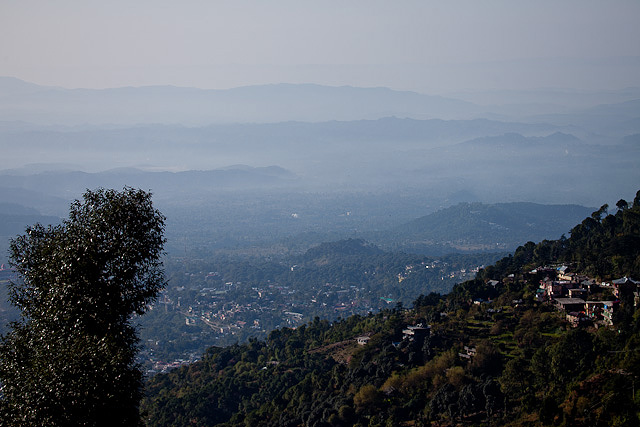
Thus began my three days of discovering the abode of Dalai Lama. But don’t let my ramblings discourage you. No sooner I settled down, I put the complaining parts of my brain to rest and saw plenty of good things in McLeodGanj. The air was crisp and the weather was pleasant, though it was beginning to get a little chilly with the onset of winter (second half of November). It was a clear day and my balcony offered views of the plains below somewhere very very far away in Punjab. Between the plains and me were several layers of hills painted in the morning blue gently fading into the plains. Immediately below me was a valley where a stream gurgled and sang happily on its way down the hills, surrounded by green grass, pine and cedar trees. It was all quiet but for an occasional caw of a magpie or an even rare honk of a vehicle carrying a tourist up or down the hill.
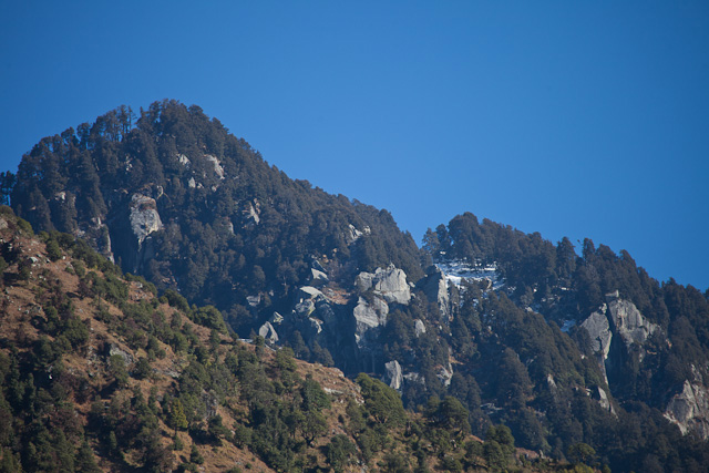
On the other side, up the hill and behind my guesthouse, the mountains climbed steeply till the snowline at Triund. Somewhere on either sides were snowy peaks which remained hidden by the hills around me, but visible after a good walk to a vantage point.
It must have been nearly four years since I made a visit to the hills on my own and reflected on the charm of cedars without having to keep company of anyone else. The crisp air, the quiet surroundings, the scenery and perhaps the good vibes from Tibetan Monks quietened my mind and subdued its train of thoughts. I put aside all my plans for three days at The Ganj, let my camera rest in the room and dedicated most of my time to walking in the hills, a bit of reading and sunning in the balcony. It was going to be a holiday for my mind, body and hopefully the soul as well.
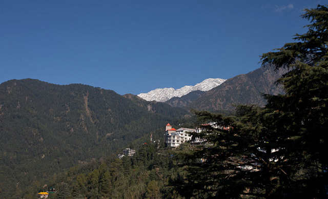
I began my sauntering along the small road that connects Bhagsu with McLeodGanj, which was going to be my favourite walkway for the next three days. I could happily go up and down in this short road that goes through an empty stretch flanked by tall trees, pausing every now for a good look at the valley and then at the tall peaks to the other side. Few vehicles took this road and occasional chai shops kept me energized when needed.
Rohtang Pass is a place that marks many divides. To the south are the green slopes caressed by monsoons every year and to its north is a stark landscape often called the forbidden valley. Beyond Rohtang, the landscape begins to start resembling Tibetan, and so do the people. Temples give way to monasteries and Shiva makes way for Buddha. Apple orchards are replaced by potato and sweet peas. It is as if you just changed the DVD and a different movie started playing on the gigantic 16:9 screen.
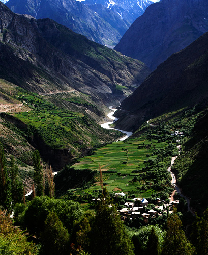
The fabulous setting of the town of Keylonw, Bhaga River and the road from Tandi
People north of Rohtang have an unusual pride about the altitude they live in. Every village along the way lays some special claims about its location. In Spiti Valley, a deviation on the Leh highway, people at Kibber Village once loved to call it as the highest permanent inhabitation in the world. When the record was broken somewhere else, they were not ready to give up. They came up with more possibilities instead: highest village with electricity, highest village with a motorable road, highest village with a post-office, and so on. A quick web search reveals all possible versions and may even give ideas to cook up new ones. Just below Kibber at the base of Spiti Valley, the petrol pump in Kaza doesn’t fall behind in making the ‘highest in the world’ claim.
Going past Keylong, probably every named place has something highest attached to it. It is only a matter of finding out highest ‘what’!? Indian Army takes bulk of the credits for creating all these highest hypes. In Pang, a tourist stopover on the way to Leh, is an army camp labeled as the “world’s highest transit camp.” Far north in Ladakh is Siachin glacier with its notorious claim for being the world’s highest battle field, where India and Pakistan have been fighting and wasting away lives and resources for a land that neither party can put to any good use. Once you have the privilege of making claims for world’s highest battlefield, the highest airfield is obviously not going to be far away. And Khardung-la, the world’s highest motorable pass doesn’t need any introductions. But Khardung-la’s days are probably numbered: everyone speaks of motorable passes in Ladakh and Tibet that raise much higher. I am sure they will find a new title for Khardung la when another pass officially becomes the highest motorable road.
That’s much digression from Rohtang Pass where we started from. It is a quick and steep descent from the pass, down to the valley of Chandra River. The small village of Khoksar next to the river is more a food court than a village. Dhabas line up the 100m or so length of the road, which is as long that the village spreads. A Himachal Pradesh Government PWD bungalow in the village may be open for visitors, but most people prefer to continue to Keylong. Despite the charm of Chandra River, Khoksar is not a pretty place and is too close to Manali for a halt.
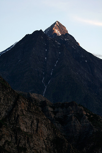
Mighty mountain peaks seen from Keylong town
The way further is parallel to Chandra River, going downstream after crossing the river at Khoksar. It is usually muddy and flows swiftly in the months of July and August – the peak season for travelling to Ladakh. Photographs taken in later months show it in a deep hues of blue, a color that eludes most people who are on their way to Ladakh. The tall peaks along the way tend to have last snow of the season, and many tall waterfalls come down from the steep hills to merge with Chandra.
Tandi, 10km before Keylong has the last petrol pump on the highway. The road here turns right and continues along the valley of Bhaga River. A sign at the confluence of Chandra and Bhaga reads [not verbatim; recreated from memory]: “Welcome to Tandi, the confluence of blue waters of Chandra and green waters of Bhaga.” Unfortunately, the colours are all mixed up with plenty of earth, and what is there to see is two muddy currents coming together into one.
Chandra and Bhaga have an interesting origin. They both begin at different faces of the mountain at the same location – Baralach la. Chandra flows east and then turns west traversing through the valley of Lahaul, while Bhaga flows south through Darcha and Keylong. They meet again in Tandi, like two long lost sisters getting to see and hug each other. More like we see siblings separated at birth rejoining in an emotional drama in a Kannada movie, with the lead actor playing two roles.
Keylong is a quick 20 minutes drive upstream Bhaga River. It is the place where most people prefer to spend the night on the way to Leh, as we found out on arrival.


