Here is a trip report of a long journey I made 3 years ago. I dug out the trip report lying in a corner in my computer.
With my newly acquired craze for driving and our zeal to see many places, a friend and myself decided to go on a long drive and visit the hill stations of South India in February 2002. The itinerary planned was Wayanad, Munnar and Kodaikanal, and drive through Ooty. We realized later that February was not the best season to visit these places, but nevertheless had a great time in the trip.
Preparation
Since we were travelling in a car and had plenty of room available in, we took as much luggage as we could and did not bother to optimize the load. Our baggage included footwear for trekking, sleeping bags, clothes and other accessories like water bottles, etc. To keep us informed about the road, we carried maps and guidebooks. We also had Salim Ali’s ‘Book of Indian Birds’ so that we can try to track down interesting birds we see on the way.
References
We tried to do as much homework as possible before we started on the journey. Along with searching the web for information, the following resources were extensively used for gathering information.
a. India Over Land Guide and roadmap
b. Lonely Planet South India Guide
c. Rough Guide for South India
While the first one provided us with some useful maps, the latter two had fairly extensive information about every place on the road.
The Journey
We started on a Sunday afternoon from Bangalore. The plan was to reach Wayanad by sunset and stay in one of the towns – Sultan’s Battery or Kalpetta. We drove thru Mysore and Gundlupet and entered the premises of Bandipur Wildlife sanctuary early in the evening. We had to drive thru the sanctuary and cross it to reach Sultan’s Battery.
Bandipur Wildlife Sanctuary
 Sun setting in Bandipur National Park
The sanctuary, along with Muthanga wildlife sanctuary in Kerala and Madumalai forests in TamiNadu, forms the Nilgiri Biosphere Reserve. The area consists of thick dry and moist deciduous forests and is home for Sambars, Gaurs, Spotted Deer, A large number of elephants and some tigers. While travelling on the road passing through the forest, you can often sight some wild life if you are lucky. While approaching from Karnataka, the vegetation is dry deciduous and consists of mostly short trees and shrubs, which slowly give way to moist deciduous forest. On our way, we were lucky to spot a majestic tusker enjoying the evening, splashing itself in a man made pond. It so happened that we were travelling on a full moon day just after sunset. The serenity and silence of the forest on such an evening is best experienced than described. We also happened to spot a few deer near the road late after the sunset. Moving from Bandipur towards Kerala border and reaching Muthanga sanctuary, the trees start getting taller and greener. To the other end of the forests is Wayanad district, and the first town – Sultan’s Battery.
Wayanad district, Kerala
We stayed in a small tourist home in Sultan’s Battery. Tourism here seems to be opening up only recently unlike rest of the state. A large population of the locals are tribal, a good number of them still living in the forests. Hence it looks like clashes between the tribals and the forest department is very common. When we were there, a major war scale confrontation was reported between the two sides and more than 40 people from the forest department were held hostage by the tribals!
Chembra Peak, Kalpetta and around
 Tea estate on the way to Chembra peak
Our next morning’s plan was to climb the 7100 feet high Chembra peak, return back to Kalpetta and spend rest of the time in the evening sight seeing around the town. Kalpetta is another small town in Wayanad around 20kms away from Sultan’s Battery. We started early in the morning around 7am.
The foot of the hill is around 30 minutes drive from Kalpetta. You need to pass through a large tea estate on the way up. You can drive your car until half way up the peak and then start walking. We were running late and it was around 10-30 by the time we started walking. It was a very sunny day, although it was foggy early in the morning. One of the best parts of climbing Chembra peak is that you will encounter a small lake half way up on the hill. It is a great place to rest and enjoy the view of the planes below.
We took a little more than 3 hours to reach the top. It is amusing how one feels after reaching the top – there is an urge to go on conquering the next taller hill, and then the one after that and so on. The peak we climbed was the tallest one around and there is a twin peak close by which is almost as tall. Looking around from the top, it appeared like there were plenty of hills and greenery further that was worth exploring. But naturally it requires some more effort and preparation.
We reached back Kalpetta from Chembra around 4-30pm and checked into the best hotel we could find in the town. Since we had two more hours to go before dusk, we decided to explore some good places around. One thing that must be appreciated about this part of Kerala is about availability of tourist information. The tariff-card that our hotel guy gave us had everything that we wanted to know. Armed with that, and lonely planet and rough guides, it took no time for us to decide where to go – Phookot Lake. It is a beautiful naturally formed lake in the forest. It is now developed for tourism and is hence disturbed by boating, a small resort and lot of people coming in. We walked around the lake, sat there for sometime and returned back to the town around 7pm.
Our next day’s plan was to head to Munnar. After fiddling with numerous maps of Kerala and TamilNadu, we were disappointed a bit to see that there is no direct road that takes us to Munnar. We had to go far to the west to Kozhikode or far to the east to Ooty and then drive south to Munnar. Since the Ooty road was much shorter than the other one, we decided to take that. Later, we realized it was not all that a good decision.
Roads and driving in TamilNadu.
The general experience we had of driving in TamiNadu was disappointing. We often had to struggle through roads in terrible shape and sometime unreasonable toll on the roads that hardly seem to exist. I have written about the experience in my weblog.
Ooty
 Waterfall near Ooty
Ooty is probably the most famous hill station in South India. After driving through the place, I realized it is worth its fame. This is probably the only place down south where you can see some coniferous vegetation – like pine trees. Although they were once planted in the place of natural forest, now they are in big numbers and have formed self-sustainable pockets. Besides, Ooty’s temperature is known to reach as low as zero degrees and that makes the climate very suitable for these trees. The Gudalur to Ooty road is so scenic that I could not stay away for long from this place and returned here only 3 weeks later! But this time, since we did not have enough time to cover Ooty, we did not stay here and simply drove on to Munnar.
On the way to Munnar
Before we reach Munnar, we had made plans to go to Indira Gandhi national park in TamilNadu. The national park also had guesthouses inside its premises on the top of a hill, called as Top Slip. Unfortunately the park was closed for summer to prevent forest fires and we were not even allowed into the park, forget staying inside. So we ended up staying in nearby town, Pollachi.
Munnar is nearly 3 ho
urs away from Pollachi. We had to travel in hilly region and the journey was slow. The initial part of the journey was dry planes that gave way to shrubs, and as we climbed higher and higher, we saw more greenery. But sadly, there is not much forest that is left in and around Munnar. You can drive for hours and hours all around Munnar only to see tea plantations and just that. If you are there in rainy season or early before summer, you can see a few beautiful waterfalls originating from sholas. We thought of climbing one of the best looking sholas and reach for a waterfall above that, but instead just drove on to Munnar. We reached Munnar in the afternoon around 1pm.
Munnar
 Tea estates of munnar
Munnar is a small town. One thing unique to this place is that you can see a lot of private tourist information centers that help you around for a fee. Places to see include some natural lakes and some artificial ones formed by dams, plenty of tea estates, some hill top viewpoints and Eravikulam National Park. Anaimudi, South India’s highest summit is inside Eravikulam National Park. Our plan was to climb this peak and move on from Munnar, but unfortunately we were denied permission since it is in the core area of the national park. That was a real dampener. We were hoping to see some Nilgiri Tarhs(mountain goats) which did not happen.
With Anaimudi ruled out, we trekked around some hills and tea estates in the first day of our stay in Munnar. The next morning we took for Mattupetty dam, around 10kms away from the town. The dam forms a large artificial reservoir around the hills and looks beautiful early in the morning. You can go on from here to Top Station – a viewpoint from a hill and take the road further to Kodaikanal. While we wanted to take this route to our next rendezvous – Kodai, since the road would require a sturdy 4×4 vehicle, we decided otherwise. Instead, we returned back to Munnar and headed to Kodai on a better road.
Kodaikanal
The road to Kodai is steep and curvy, and because it is narrow, is also a dangerous. The road offers some excellent view of the planes below all the way. There is not much forest left around Kodai too. Unusual as it may seem, people here grow plantains on the slopes!(They are normally grown in planes in places where you can get plenty of water). Where you don’t see plantains you will see the natural vegetation replaced by Eucalyptus trees.
We reached Kodai early in the evening. Accommodation is cheap in Kodai if you go in off-season. Kodai is an ‘association country’. There is probably an association for every profession in town. If you walk through the main roads for a few minutes, you will find boards of many of them – like taxi driver’s association, tourist guides association, builder’s association, eucalyptus oil makers association and a lot more. I assume these associations try to control prices(and many other things) to ensure good business. You will notice that cab hiring prices are fixed, and steep even on days when they hardly seem to have any business. Tourist information is hard to come by and you will have to struggle for getting maps, guides or permissions where needed.
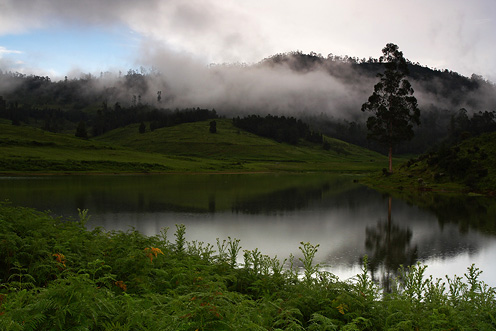
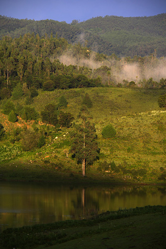
Once we got settled with all the info we need and a place to stay, we went to explore the Kodai Lake. The lake is surprisingly clean and beautiful, doubly so in the evening. There is a road that goes along the shore where you can walk, cycle or drive around. it was around 6-30pm when we reached the lake and it was deserted for good. We walked the entire 5kms around the lake and came back tired and ready for a good dinner, and crashed out after eating. The next morning, I drove down to the lake again, with my Camera. Since I went in early, there were not many people except for a few morning walkers and I managed to get some beautiful pics. There was not much wind and I managed to get some excellent reflections from the lake.
After breakfast, we took to PerumalMalai peak, around 12kms from the town. The climb to the peak begins at a village called Perumal Malai. We drove up to this point and started climbing at around 10am. The peak is more than 7000feet above sea level, and is a 10km walk from the base. It is a moderate climb and we took around 3 hours to reach the top. The peak offers a good view of all the four sides. We had our lunch at the top and sat there for nearly an hour or so. During the descent, we decided to go off the path, went around bushes, lost our way briefly for a while and spent some time walking around. We reached back to Kodai around 4pm.
 View from Perumal Malai peak
Once in Kodai, we went to Pillar rocks, a vista point where you can see some huge pillar like formation of rocks and a view of the valley below. The place is beautiful and worth a visit. And that was pretty much the end of all our sight seeing and treks. Later on, I bought a few packs of delicious ‘home made chocolates’ that are supposed to be locally made. These chocolates are good and can be added to ‘not to be missed’ list in Kodai.
 Scene at Kodaikanal
That was our last day of the 6-day trip. We started back for Bangalore next morning and reached the town in the evening.
