Up next, after compiling images from Hampi and Rajasthan, here is a collection of images of Landscapes of India – mountains, hills, deserts, waterfalls, lakes, rivers, flowers and much more. They were created over a period of nearly 8 years, travelling across the country.

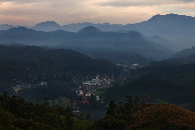 A few days ago, I posted here a photograph of a small town nestled in a valley surrounded by picturesque hills all around it. Mountains rose steep in every direction, making the man-made structures in the town look small and fragile. I posted a question along with the image (reproduced here to the right), asking where the photograph was taken. The image had no obvious clues or landmarks that revealed the location. The place from where the photograph was taken was inaccessible by road, which meant there did not exist a million images from that angle that people would have become familiar with. It would not be an easy guess. But I had not thought about Siby when I asked the question.
Siby knows Munnar like no one else does. His detailed response on this blog’s facebook page baffled me, because even me, the photographer, did not know all those details he mentioned about the location. He said –
“its from west corner of Cokkanmudi…parvathy hills on left and Annamudi is fathest  Shangumalai, Periyavarai, Elamankai, Munnar town also seen from this”
That’s how much Siby knew Munnar. He not only knew the place very well, but loved these hills to no end. He had explored every part of these hills, knew the geography, history, people and the wildlife of the region to the maximum detail. If a birding enthusiast wanted to know where to see certain species of bird, Siby was the person who had the answers. He knew where to see the best landscapes, where the clouds arise in what seasons; he knew the history and heritage of Munnar; he seemed to know everything.
My meeting with Siby happened through a chain of incidences – the kind of long pieces of stories that chance puts together. In a conference on adventure tourism, I had met the genial folks from Green Spaces, Munnar. Nearly two years later, when a British travel company wanted me to do some research in Kerala, I resorted to their help. They, in turn, put me in touch with Siby besides offering a few pointers on what to do in Munnar.
Thus, I went to places that I may not have visited on my own, like the Tea Museum and Kolukkumalai Estate. But more than any other place, I had a memorable visit to a valley of clouds, where every morning, a predictable assembly of clouds decorated the hills and disbursed the glorious morning colours all across the valley. To get to the place, Siby took us on a jeep ride for about 20km from the town, then made us wear leech socks and climb a steep slope in thick evergreen forest through a leech-infested path. We reached the place – a camp in the wilderness – a little late on a foggy and rainy evening, when the valley was filled white with thick fog. We knew what to expect in the valley from photographs, but had to wait till next morning to see them all for real.
The evening’s dinner was prepared as Siby narrated stories of Munnar’s history, wilderness and wildlife, including sighting a tiger only a month ago on the path that we took to the camp: ‘they brought machinery for starting tea factory on a huge lift that ended at top station; much of Munnar’s slopes are tea estates now and you find natural forest only in Eravikulam National Park; a photographer recently shot a Nilgiri Martin in the national park;…” As we listened to the stories over a bowl of fried rice, a pacific swallow fluttered in the room fearless to our presence, often flying in and out of its nest in a corner of the camp.
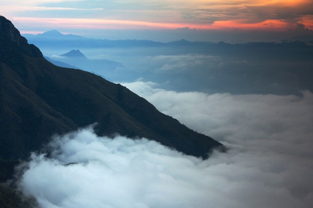
The next morning, rain had subsided and fog had cleared up. Right next to us, the hills of Munnar tumbled into the plains of Tamil Nadu, leaving its expanse bared to our eyes. The clouds spread on a layer above the plains, unable to climb up the slopes and held captive between two arms of the hills to either side of us. The rising sun added a dash of bright colours on the horizon and cheered for the brilliant morning. I was content with seeing the drama that unfolded, although Siby had a label for everything we saw that morning: ‘seen below is Bodhinayaganur; faraway on that side is top slip; those are the lift stations that the British had built,..’ and so on.
The drama did not end soon after the sunrise. Later, Siby took us on a short walk further up the hills to the grassland sholas, where the strong wind blew fog into us every once in a while, suddenly masking the landscapes and unveiling it soon after.
In one of those moments when fog played with us, it offered a glimpse of Kolukkumali Peak and the tea estate that carpeted its inclines. I could identify it well, as I had made the long journey to Kolukkumalai Tea Estate in an ancient Mahindra jeep only the day before. The bumpy ride through the tea plantation was probably less than 10 kilometers, but took more than an hour over the rocky unmetalled road that tore my backbone into pieces. The slopes on the way were green and beautiful, but all through the journey, I could not help but muse on how beautiful and virgin jungles these tea estates were two hundred years ago. (Read: impact of tea estates on environment).
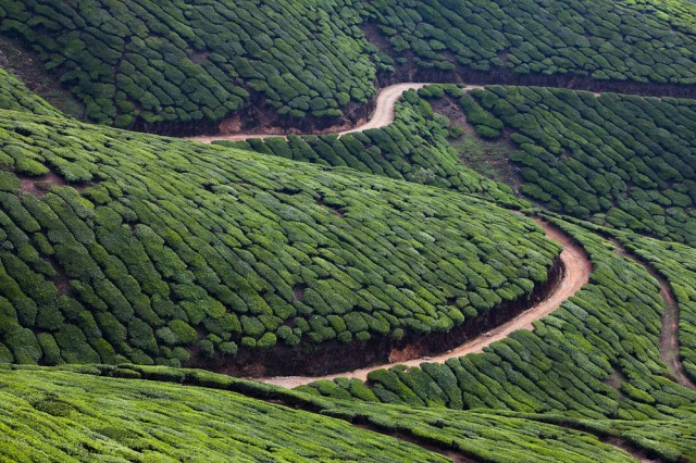
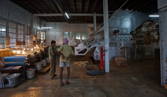
But one has to bear the pains of this journey if one wants to visit the “world’s highest organic tea garden.” The rewards are in the form of a drive through one of the most scenic tea plantation in the region that culminates in an 80 year old tea factory next to the prettiest vista of the hills. Mani, the friendly guide at the factory took me inside the factory, explaining the transformation of tea leaves into a packaged product after it goes through drying, grinding, fermentation and filtration. And unlike any other place of industrial production, Kolukkumalai Tea Factory is a camera friendly place.
After inspecting tea making, it was time to taste the final product. At the Tea Museum near Munnar, I had a taste of tea’s history along with a taste of several varieties of the world’s favourite beverage. In the much crowded tea museum, I watched a twenty minute movie on the Kannan Devan Hills, on the way it was transformed by the industrious British who planted tea all over the slopes, its ownership changing hands into Tata Tea and eventually the formation of a co-operative to govern the Kannan Devan plantations. Subsequently, while a packed crowd was herded by a loud-speaking guide through a more modern tea factory, I got out and signed up for a tea tasting session.
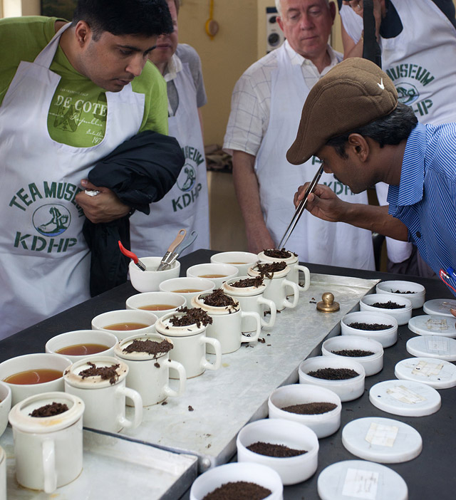
The session on tea-tasting was more interesting to watch than to taste. Our young tea-connoisseur at the tasting lab, Krishna, knew his tea well. While we sat and watched, he slowly poured several varieties of tea into a line of cups that were laid on a table. He explained in detail about different variety of tea and the discipline of tasting the finished product. But what evoked a smile from all of us was the fact that a person in the tasting profession should abstain from spicy foods, tobacco and alcohol. Perhaps it is the spiciness in the food that we Indians eat, it largely disqualifies us from appreciating the finesse in these beverages. I found much of the teas there tasting similar, each one differing only slightly from its neighbour.
I was back in Munnar a year later, this time to share my discoveries from last visit with a group of energetic people interested in learning to photograph the landscapes of Munnar. (Read: Landscape Photography Workshop at Munnar). While I had made some plans and set an itinerary, another set of calls and timely assistance from the folks at the resort where we stayed helped us make some more discoveries of great views that the hills can offer. On our first morning at Munnar, I pushed the group to make an early morning half-an-hour climb to see sunrise over a ridge that offered the finest views of Munnar Town and the hills nearby. Up there, going by Siby’s words, we could see “parvathy hills on left and Annamudi is fathest  Shangumalai, Periyavarai, Elamankai, Munnar town also seen from this.” What Siby did not mention was that the ridge also offered views of Pothemedu Valley on the other side, not seen in the first photograph above. It was all that a landscape photographer could ask for – views of the tallest peak in South India to one side, and what was perhaps the deepest valley in the region to the other side.
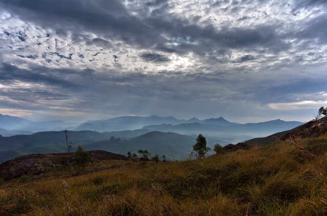
In the three day that we spent photographing the drama in these mountains, we drove through beautiful ‘view points’, valleys inhabited by rivers, slopes carpeted with lush grass and tea-estate landscapes of Kolukkumalai and beyond. The riches of Munnar, it seems, doesn’t stop here. Another meeting with people who knew these hills revealed me yet another valley of so much beauty that I could never imagine existed in the hills of Munnar. Right now, I am looking for gaps in my calendar for another visit to Munnar.
Every traveller becomes a photographer-at-ease on his/her journeys through Ladakh. As a friend who recently returned from Ladakh remarked, every photograph looks like it is post-card worthy. Sometimes, this incredible landscape comes with its challenges. It becomes difficult to make images that are distinct from the millions of frames that flood the internet and to capture something that stands out from the rest. But an effort goes on, nonetheless.
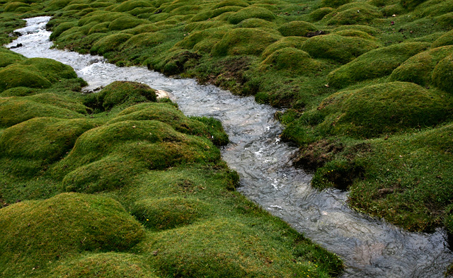
Ladakh is a high altitude desert with barren slopes, stark landscapes and treeless terrains. Yet, it has no shortage of water which flows abundantly from snow melting through the summer months and feeding its streams and rivers. In the rare occasions where you see some table lands fed by such streams, you also see an eruption of greenery that is a contrast from the brown landscapes surrounding it. Here is one such place near Tso Moriri Lake.
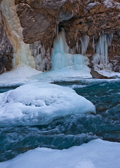
While Ladakh is easily accessible in the summers and rewards the visitors with its beautiful landscapes, jaw-dropping spectacles unfold in the winter months. Temperatures dipping twenty below zero changes the way the world appears, like in the case of this waterfall that stays frozen during the winter months next to a blue Zanskar River.
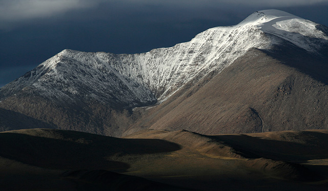
Snowfall is rare in the summer months. But when it happens, a day of snowy surprise can bring in magical changes in the landscapes. This mountain, near Tso Moriri Lake, was largely brown on the day I arrived here. It snowed one night and remained cloudy for the large part of next day. The slopes were transformed by the fresh, powdery snow.
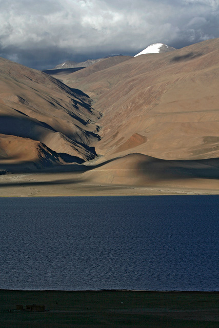
One of the prized possessions of Ladakh are its vast, blue lakes that are trapped in the depressions of changthang plateau. Tso Moriri is one such lake whose blue colours stand out against the chocolate-brown slopes surrounding it. Next to the lake is a small pasture that feeds the animals. and fields that feed the people of Korzok Village overlooking the lake.
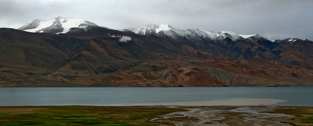
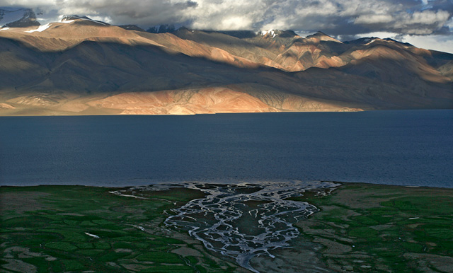
Tso Moriri takes different hues in different weathers, varying from deep blue on a sunny day to a dull grey when it is cloudy. Perhaps it simply reflects the colour of the sky, calling nothing its own. The lake is fed by streams like the one in the picture above. The lake’s waters have no outlet, because of which it is turning salty over ages. The waters of this brackish lake tastes mildly salty, if at all, and has only a fraction of saltiness that the seawater possesses.
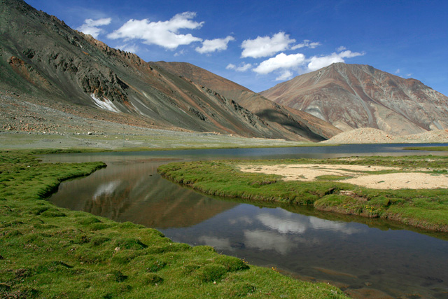
Pangong Lake is another brackish water lake in Changthang Plateau. But one doesn’t have to take Ladakh destination by destination. Stop anywhere for a break and you will find something beautiful, like this unnamed lake on the way to Pangong Tso.
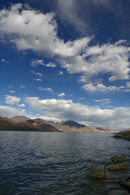
Pangong Lake itself, is the grandest of all water bodies in Ladakh, perhaps in the whole country. It stretches for more than a hundred kilometers across two countries. A man from Indian Army who helped me park my bike here said, ‘do you see the mountains far away? They are in China’.
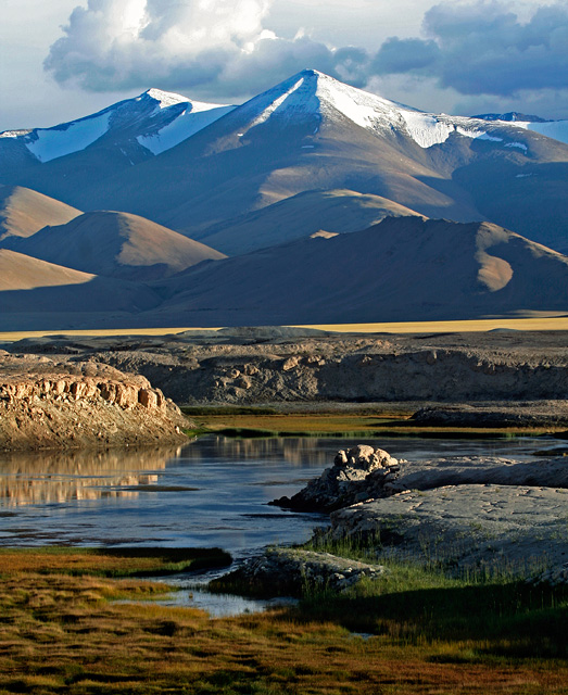
Another large lake in Ladakh is Tso Kar, which is more of a marshland than lake. The huge plain of Tso Kar allows plenty of grass to grow in the plateau and in turn supports a variety of wildlife that feed on this grass.
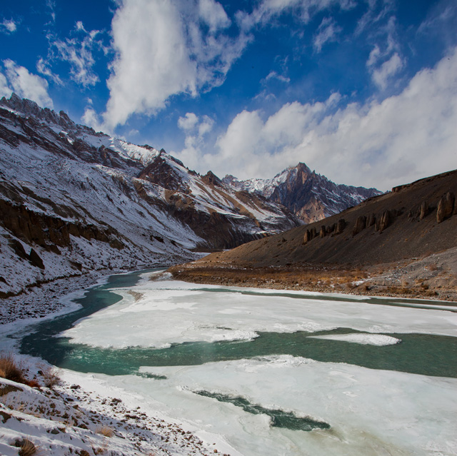
Tso Kar Lake and rest of Changthang Plateua lie on one side of Manali-Leh highway, while on the other side is the still-remote and inaccessible Zanskar Valley. The lone road to Zanskar remains closed for nine months a year, buried in snow. In the winter months, the frozen Zanskar river then becomes the highway for people of Zanskar.
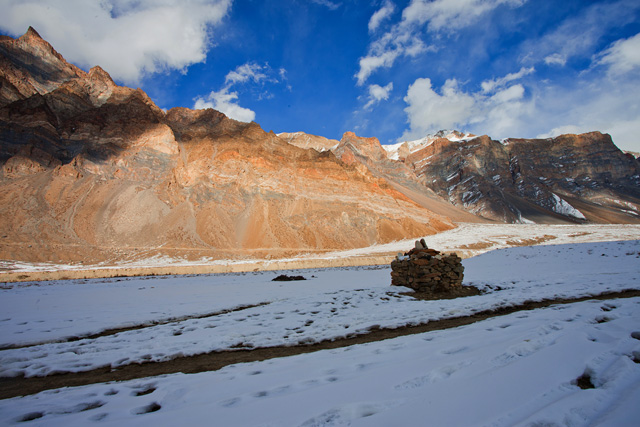
Snow filled Zanskar Valley in the winter months.
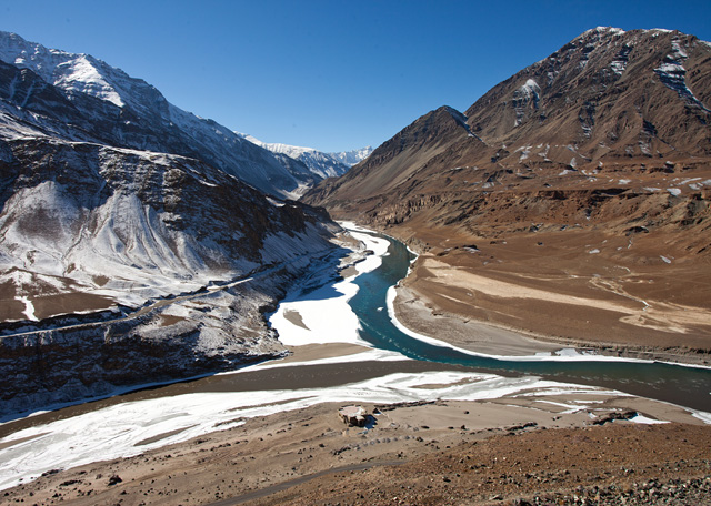
Zanskar River enters Indus Valley and merges with River Indus near a village called Nimmu. In the above photograph is the confluence, seen from the slopes nearby. The deep blue river emerging from the mountains is Zanskar, while the muddy flow from the left is Indus River.
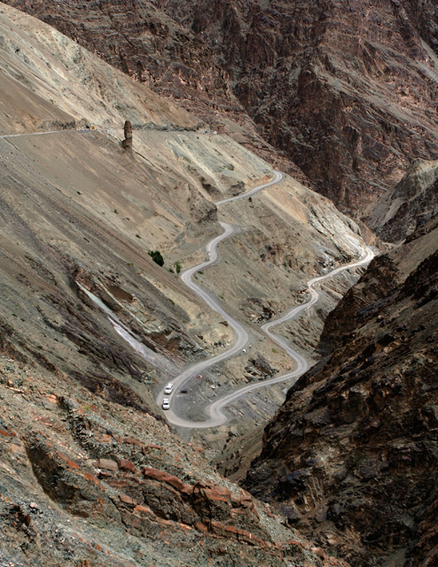
Further, downstream Indus is the village of Lamayuru, which is approached by switch back roads climbing swiftly along the steep slopes. Some turns along the way are so tight that buses have to go back and forth to get past a curve. This road is part of the Srinagar-Leh highway.
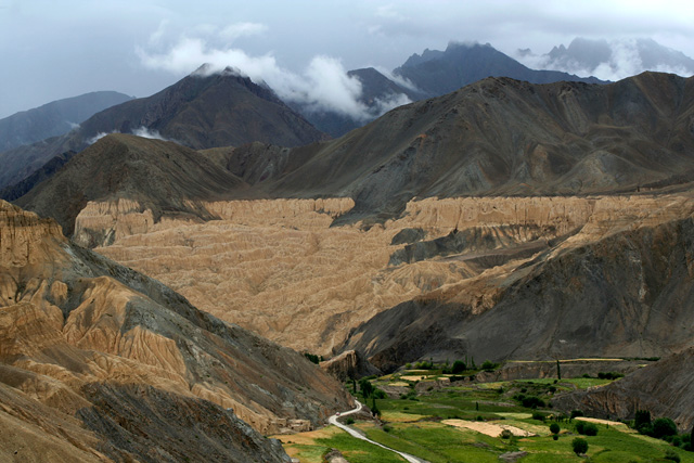
Lamayuru Village is located in a place that was once inundated with waters of a high-altitude lake. The presence of the lake is apparent even today, thanks to curious formations left behind from the drained lake. The yellow slopes, often called moon-land-view, clearly indicate the level of the lake’s water.
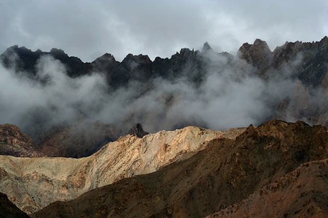
Play of sun and clouds on the mountains of Lamayuru.
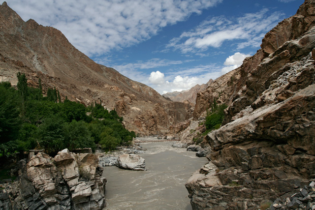
Further downstream, at the edge of Ladakh before Indus flows out of territory accessible from India, the river flows swiftly through a very narrow gorge near the village of Dha. In here, the river descends below ten thousand feet after flowing for a long distance in the highlands of Tibet and Ladakh. The mountains here are steep and the valleys are narrow, but the weather is more hospitable and permits growing a variety of fruits and vegetables. This is perhaps the only place in Ladakh where it is possible to grow wheat.
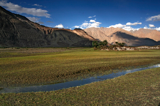
In another corner of Ladakh, towards north, is Nubra Valley, another green oasis in the barren lands of Ladakh. In the wide valley of Shayok River, tiny grass and seabuckthorn shrubs grow in plenty, supporting a small herd of wild bactrian camel. The lush valley with plenty of water from the river allows the people of Nubra Valley to grow many cereals and vegetables, besides juicy apricots.
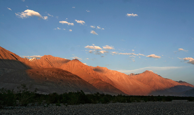
Sun setting over the mountains of Nubra.
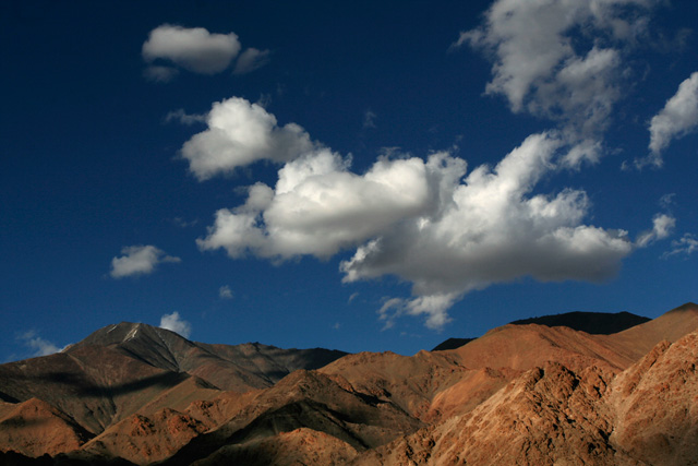
But one doesn’t necessarily have to travel far and wide to every corner of Ladakh to see its amazing landscapes. As soon as you arrive in Leh, you will see tall mountains, puffy white clouds and blue skies welcoming you to Ladakh. A small walk outside Leh is perhaps sufficient to get the glimpses of Ladakh’s landscapes. The explorer, however, has no limits to to what he can see in Ladakh.


 Shangumalai, Periyavarai, Elamankai, Munnar town also seen from this”


