My first proper day in Leh started with a rush to the ATM. In a town that has more tourists than locals, your best bet to get your money from the only functioning ATM is to get there early in the morning. At 10am, the queue was already long enough that it took me an hour of waiting, a few tense moments of machine malfunctioning and rumours that the money is running out. I had to get some money that day or go hungry till tomorrow! Thankfully things turned out for good.
Leh is not a place where you want to hurry things. And hurry, we did not. When we asked our guesthouse owner for something do that evening, he pointed us towards Shanti Stupa. Stepping out and loosing our way through the maze of roads in Sankar Village, I spotted a little girl and asked for directions.
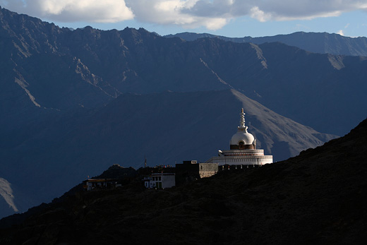
Shanti Stupa
“Julley..,” I greeted her, using the Ladakhi word for ‘hello’, and asked for directions to Shanti Stupa. Incidentally, julley can mean ‘hello’ as well as ‘good bye’.
She looked up with her bright face and smiled in return, the kind of innocent smile that makes you fall in love in that very moment. She pointed me towards North in response, added that she is heading in that direction and will show us part of the way. I asked her a few more questions as we walked together, but she did not have answers to much of them. “I am from Kargil,” she responded instead, indicating that she doesn’t know much about Leh.
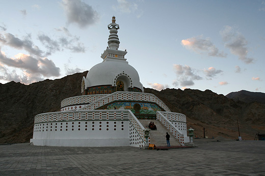
Shanti Stupa
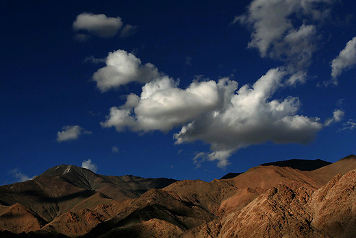
Puffy clouds over Ladakh Range of Mountains, seen from Shanti Stupa
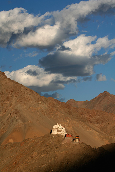
Evening light over Namgyal Tsemo Monastery, seen frmo Shanti Stupa
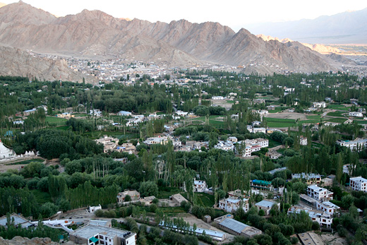
Like everything religious in Ladakh, Shanti Stupa is also located on a hill. The way up appears easy on looking up from below, but as I walked, I became conscious of the thin air in this high altitude (10,600 feet, 3500 meters) and had to cut down my pace. The vista of the mountains got better as I climbed up, bringing in the whole town into the view from the top. Shanti Stupa itself is not an admirable structure, but the panorama of the Indus Valley from its premises, with its green stretch spreading like an oasis in the middle of dry brownish mountain ranges, gives a perspective of the scale of the landscape that accommodates Leh. Puffy white clouds hovered over brown mountains at one side, while the cold snow claud mountains of Zanskar were kissed by dark rain bearers to the other side. At the opposite side of the town, the last rays of the sun gently moved past a crag hosting Namgyal Tsemo Monastery, making a distinct mark between the arriving night and departing day. At the twilight hour, peace prevailed in the atmosphere despite the crowded platform of the Stupa. Shanti Stupa is the best place to watch the sun drift over the skies above Leh.
Much before I begun the journey to Ladakh, I already had a mental picture of the way Leh would look. I create such imagery in my mind about the places I long to visit – something worth doing when you can’t get there any soon! I have had such images of Rishikesh once, which eventually did not quite fit my imagination. I still keep thinking how Leh and rest of Ladakh would look in winter – it is something I would like to see and experience. I tend to drift often imagining of the landscapes of Scandinavia, of Bayon temple in Cambodia, the Mekong Delta in Vietnam, Yukon province in Canada, the penguin infested Antartica, rain forests of Namdhapa, vast waters of Amazon, foggy peaks in the Andes, arid planes of the Tibetan plateau, the Andamans, Orccha, Kabini,.. It would be a shame to see the list ending. It never will.
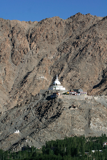
Shanti Stupa is visible from every corner of Leh Town
Coming back to the Leh of my imagination, I can’t point a source that helped build my concepts. It could be a few mountain stories that I read, pictures brought back by travellers, the romanticization of Tibetan Buddhism and culture, or the shangrila dream that makes people journey into these mountains. My Leh was so dreamy and picturesque that it could not have been real. And it did turn out that way.
My Leh was a small place, not more than a kilometer from end to end, despite being the largest town in Ladakh. But that single kilometer would be a traverse through several ups and downs and walking it would mean a lot of time and effort in the thin mountain air. Population would be sparse, with just a few people on the road – an equal mix of travellers and locals. Travellers from the west, mostly. The locals on the street would be elderly Buddhist, which you could tell from their traditional attire, wrinkled mongoloid faces and the prayer wheel constantly turning in their hands. Those compassionate Buddhists would walk gently up and down the slope with no worries of tomorrow or no hurries of today, and would smile and nod affectionately when eyes meet. A few houses would be jutting out from the steep mountain slopes, Leh Palace being the dominant of them. Just out of the town and you would already come face to face with the desert-like moonscapes that Ladakh is known for. Indus would be flowing furiously somewhere deep in a valley, a narrow strip of greenery spread on either side of it. Life would move slow, easy and happy. There would be murmurs of some chantings early in the morning as the monks would assemble for prayers at a monastery perched high on a crag. There would be an air of mystery to everything, and awe me, the tourist (traveller, if you please) on arrival.
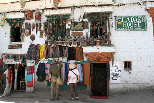
Tourists looking for things to take back home!
The real Leh, obviously did not fit well into the imaginary one. The first disappointment comes much before arriving at Leh. Its suburbs – typical of any Indian town seeing its boom days – begin much before the town makes an appearance. Choglamsar, an extension of Leh upstream of Indus is an ugly sprawl spreading sloppily along the highway. It is quickly evident that Leh is not a little pictureque hamlet that welcomes the tired traveller and makes him feel at home. It is just another urban expanse that takes advantage of the wide plains on the bank of Indus – a rarety in the mountain landscape of Ladakh.
The town is packed with travel services that has been the prime money maker for it’s people for many centuries. Historically, Leh was supported by the merchants who wandered between Tibet, Xinjiang and Kashmir. It is now the tourists who come in search of novelty from every part of the world. The main market, rather small stretch of road for the size of the town and its suburbs, is all about keeping the tourist comfortable. There are trekking and travel agencies, souvenir shops and restaurants that offer ‘palace view’. Extending to the north of the market are long lines of hotels and guest houses that never seem to end. I had my first warnings about Leh being a tourist trap when I read Pico Iyer writing about Leh as a place where you may “learn ‘traditional Thai massage’ on the streets of Leh, dine at a Korean restaurant called Amego”, but I was too comfortable in my dreams to heed to those warnings. The Leh in my dreams was how I decided to keep it, at least till the time comes when I see it.
But not everything is in the negative. Hidden just west of the market, no more than a ten minute walk is a glimpse of the old Ladakhi Village that has kept some hints of its past. The traditionally managed fields of barley and potato in Sankar Village are a green expanse with water channels and walkways crisscrossing them. Elderly men in goncha (traditional Ladakhi dress) are occasionally seen diverting water into their fields. It takes a longer walk to see a house or two built in Ladakhi style, but the quiet lanes on the way make it worth the effort.
In the direction opposite to Sankar, just below the main market, the old merges with the new. Departmental stores, internet centers and souvenir shops occupy the buildings, while women in traditional clothes sit on the footpath, yapping among them and selling apricots and carrots from their garden. A 100m away further east of this market, old men keep themselves busy turning prayer wheels while awaiting customers for their piles of dried apricots and other nuts. Hidden right in the main market, behind a small array of shops is the Soma Gompa – the prime monastery in Leh where men and women assemble in the morning to listen to the prayers from an assembly of monks. But it is modern Leh that dominates the scene, the old town hiding quietly behind it.
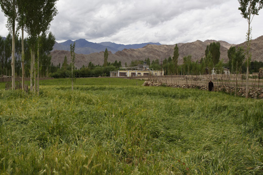
The fields of Sankar Village are just a 10-minute walk from the main market
Yet, the most dominating structure in the town-center does not belong to any of the hotels or tour companies. It is the four hundred year old palace built by King Sengge Namgyal. Further, looming large far away on the mountains are the beacons that stay in view from every part of the town – the Shanti Stupa to the north and Tsemo monastery to the south. Leh itsels is sandwiched on a plateau between the hills holding these structures. To the west are the hills of Ladakh ranges that host Khardung la, much publicised as the highest motorable pass in the world. And to the east is River Indus that flows in a wide valley amidst plenty of greenery from the fields of hardworking Ladakhi farmers. Unlike the Indus in my imagination that ran fast and furious in a narrow valley, the river here flows gently through a wide plain, irrigating the barley fields along its bank. Past the river are mountains of Zanskar ranges that stand taller than the Khardung la, the peak of Stok Kangri dominating them all.
Even when Leh did not fit my imagination, it effortlessly put me in an awe. The views from Shanthi Stupa are the most memorable of what Leh had to offer me. The arid mountains dominated the landscape, with the Oasis of Leh lying in a trough in the Indus Valley. I stayed put in Leh for more than a week, before making a lethargic attempt to explore deeper parts of Ladakh.
Rohtang Pass is a place that marks many divides. To the south are the green slopes caressed by monsoons every year and to its north is a stark landscape often called the forbidden valley. Beyond Rohtang, the landscape begins to start resembling Tibetan, and so do the people. Temples give way to monasteries and Shiva makes way for Buddha. Apple orchards are replaced by potato and sweet peas. It is as if you just changed the DVD and a different movie started playing on the gigantic 16:9 screen.
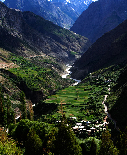
The fabulous setting of the town of Keylonw, Bhaga River and the road from Tandi
People north of Rohtang have an unusual pride about the altitude they live in. Every village along the way lays some special claims about its location. In Spiti Valley, a deviation on the Leh highway, people at Kibber Village once loved to call it as the highest permanent inhabitation in the world. When the record was broken somewhere else, they were not ready to give up. They came up with more possibilities instead: highest village with electricity, highest village with a motorable road, highest village with a post-office, and so on. A quick web search reveals all possible versions and may even give ideas to cook up new ones. Just below Kibber at the base of Spiti Valley, the petrol pump in Kaza doesn’t fall behind in making the ‘highest in the world’ claim.
Going past Keylong, probably every named place has something highest attached to it. It is only a matter of finding out highest ‘what’!? Indian Army takes bulk of the credits for creating all these highest hypes. In Pang, a tourist stopover on the way to Leh, is an army camp labeled as the “world’s highest transit camp.” Far north in Ladakh is Siachin glacier with its notorious claim for being the world’s highest battle field, where India and Pakistan have been fighting and wasting away lives and resources for a land that neither party can put to any good use. Once you have the privilege of making claims for world’s highest battlefield, the highest airfield is obviously not going to be far away. And Khardung-la, the world’s highest motorable pass doesn’t need any introductions. But Khardung-la’s days are probably numbered: everyone speaks of motorable passes in Ladakh and Tibet that raise much higher. I am sure they will find a new title for Khardung la when another pass officially becomes the highest motorable road.
That’s much digression from Rohtang Pass where we started from. It is a quick and steep descent from the pass, down to the valley of Chandra River. The small village of Khoksar next to the river is more a food court than a village. Dhabas line up the 100m or so length of the road, which is as long that the village spreads. A Himachal Pradesh Government PWD bungalow in the village may be open for visitors, but most people prefer to continue to Keylong. Despite the charm of Chandra River, Khoksar is not a pretty place and is too close to Manali for a halt.
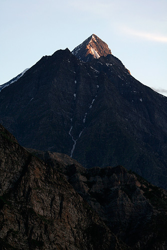
Mighty mountain peaks seen from Keylong town
The way further is parallel to Chandra River, going downstream after crossing the river at Khoksar. It is usually muddy and flows swiftly in the months of July and August – the peak season for travelling to Ladakh. Photographs taken in later months show it in a deep hues of blue, a color that eludes most people who are on their way to Ladakh. The tall peaks along the way tend to have last snow of the season, and many tall waterfalls come down from the steep hills to merge with Chandra.
Tandi, 10km before Keylong has the last petrol pump on the highway. The road here turns right and continues along the valley of Bhaga River. A sign at the confluence of Chandra and Bhaga reads [not verbatim; recreated from memory]: “Welcome to Tandi, the confluence of blue waters of Chandra and green waters of Bhaga.” Unfortunately, the colours are all mixed up with plenty of earth, and what is there to see is two muddy currents coming together into one.
Chandra and Bhaga have an interesting origin. They both begin at different faces of the mountain at the same location – Baralach la. Chandra flows east and then turns west traversing through the valley of Lahaul, while Bhaga flows south through Darcha and Keylong. They meet again in Tandi, like two long lost sisters getting to see and hug each other. More like we see siblings separated at birth rejoining in an emotional drama in a Kannada movie, with the lead actor playing two roles.
Keylong is a quick 20 minutes drive upstream Bhaga River. It is the place where most people prefer to spend the night on the way to Leh, as we found out on arrival.


